 DSNews The homepage of the servicing industry


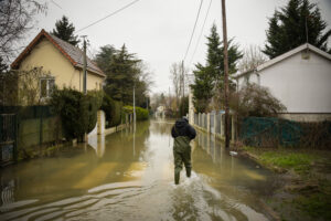 Due to two catastrophic anomalies occurring at the same time over the West Coast, two terms, “atmospheric river,” and “bomb cyclones” will be forever remembered as the cause of record amounts of rain, flash flooding, and mudslides this year as a near continuous storm lasting from Dec. 31 to Jan. 9 occurred throughout the region.
Breaking a years-long dried streak, the 2022-2023 winter season brought in unseasonably wet conditions as multiple atmospheric rivers, frontal systems, and a “bomb cyclone” inundated the entire coastline, resulting in heavy rainfall that saturated much of California, and caused localized riverine and flash flooding, causing mudslides in the process.
These rivers, which are typical, were particularly strong and tightly spaced. This set of rivers have produced on average 30 inches of rain in California, a particularly drought-stricken state.
According to the National Weather Service (NWS), they reported two to four inches of rain over a 24-hour period ending Jan. 1 across the Sacramento region and more than five inches of rain in San Francisco by mid-afternoon on Dec. 31. Heavy rain continued over the central and southern regions of California throughout the following day. On Jan. 4, a second storm system brought additional heavy rainfall and hurricane-force wind gusts to homes across California.
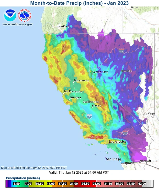
Then, a frontal system combined with a second atmospheric river brought constant, and at times heavy, rainfall over a two-day period ending Thursday, Jan. 5. One to two inches of rain fell over a 24-hour period in Sacramento, San Francisco and San Jose. Outside of these cities, maximum 24-hour rainfall totals exceeded five inches. Heavy rainfall continued over California throughout the Jan. 7 weekend. Two-day rainfall totals exceeded six inches along the coast near Santa Rosa, San Jose and San Luis Obispo. Additional rainfall fell over California throughout the week of Jan. 9, as another atmospheric riverine brought moisture to the waterlogged state.
The bomb cyclone occurred around the date of Jan. 4, which is an area of rapidly dropping pressure that causes extreme windspeeds due to the wildly swinging pressure gradients. Some locations even experienced hurricane force winds of at least 75 mph—and pushed 90 mph— in Paradise, California, causing localized building damage. Another notable example was a minimum sustained wind speed of 65 mph in downtown San Francisco.
On top of record atmospheric winds and heavy rainfall, some locations were hit by flash flooding which even stranded vehicles on Hwy 99 forcing authorities to close the well-traveled road.
Residents hit hard in recent days need to follow the old adage, “survive, repair, recover” as the five-day forecast includes yet another atmospheric river moving over the state. Some areas may see an additional four-to-five inches of rain.
The NWS, along with some companies, such as the one cited in this report, CoreLogic, have special teams monitoring the situation in case rapid-response measures are needed.